

The ground under the Kullu valley
The Beas has filled its valley with river and glacial deposits — boulders, cobbles, pebbles, sand and silt — laid in a floor and in terraces; two levels of terraces are marked near Bhunter. Those loose deposits hold the valley's groundwater. Around them the hills are old rock: slate, phyllite, quartzite, gneiss and granite, where water moves through joints and fractures, and comes out as springs.
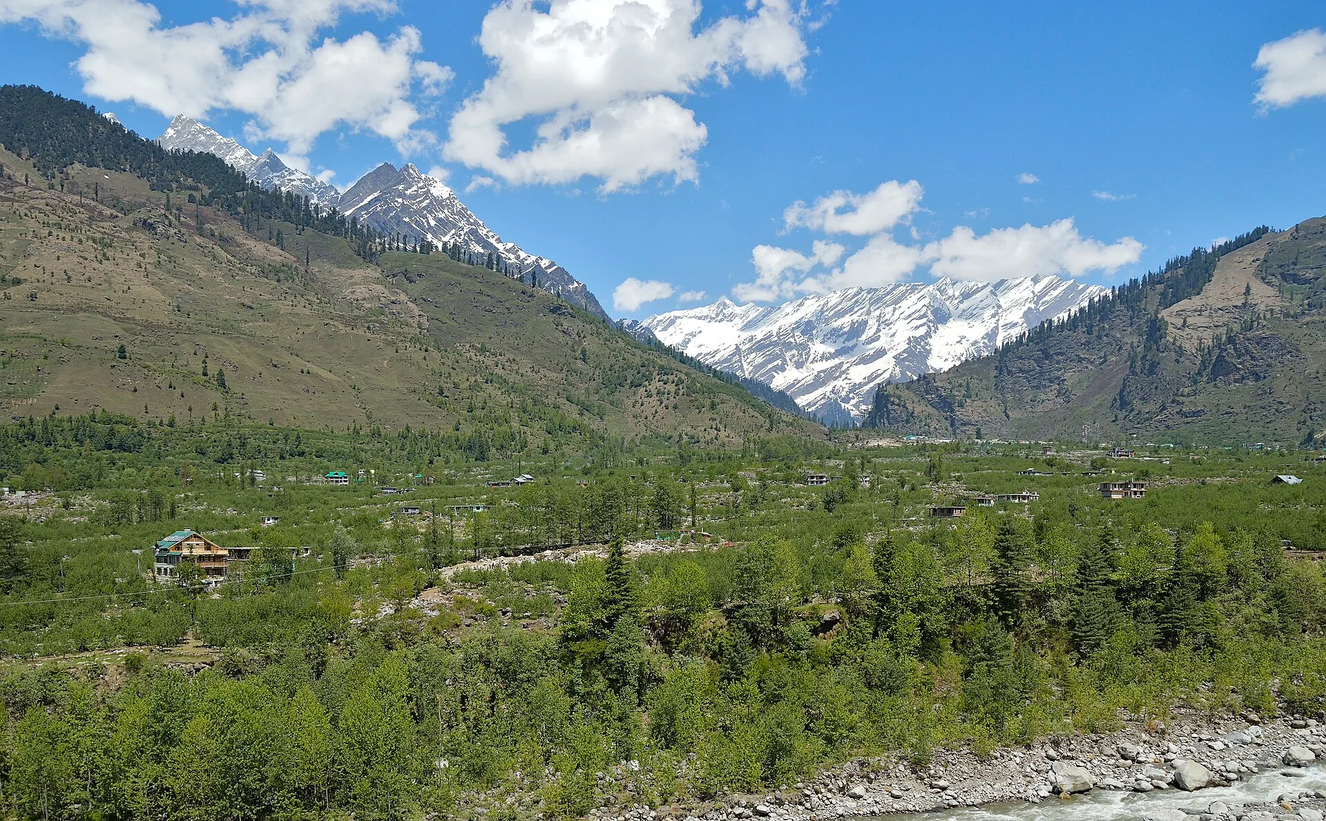
CGWB, Ground Water Information Booklet, Kullu District (2013)
The valley in numbers
- Standing water level
- 1.6 – 31.5 mbelow ground, in the valley
- CGWB test wells
- 18 – 101 mnine drilled in the district
- Their discharge
- 299 – 1,079 l/min
- River deposits
- 10 – 25 l/syield prospects rated high
- Hill rock
- 1 – 5 l/srated low to moderate
- Soil depth
- 50 – 100 cm
Under a Kullu site
What the drill goes through
No two sites are the same. This is the kind of ground the Kullu valley is made of — from the Central Ground Water Board's report on the district — and what happens in each layer.
to 1 mTopsoil SoilSoil in Kullu is usually half a metre to a metre deep. The rig's foot clamp sits on it; the first metre goes quickly.
to 18 mRiver boulders and cobbles BouldersThe valley floor and its terraces are river and glacial deposits — boulders, cobbles and pebbles with a little clay. Loose ground like this caves in if a hole is left open.Casing goes in here
to 45 mSand, silt and pebbles GravelUnder the boulders, sand and silt with pebbles. In the Kullu valley these loose river layers are where groundwater is held, and the Central Ground Water Board rates their yield prospects high.Water-bearing layer — 38 m. An example — every site differs
to 65 mWeathered rock Weathered rockOn slopes and terraces the drill can meet the valley's rock — slate, phyllite, quartzite. Broken, weathered rock can still carry water in its joints.
to 150 mHard rock RockDeep, hard rock is cut by the DTH hammer: air from the compressor drives it and blows the cuttings up and out. Here water moves mainly through joints and fractures.
to 250 mDeep rock Fractured rockBelow about 150 m the drill is in solid rock, and any water comes through fractures. Only the truck rig reaches here — rod after rod, with the compressor's air working the hammer all the way down.Truck rig only
Layers and depths are an illustration based on CGWB, Ground Water Information Booklet, Kullu District (2013) — not a survey of your site.
Why no one can promise water
What decides depth and yield
Groundwater changes a great deal from one place to the next. These decide how deep a bore goes and how much water it gives:
- 01
Local geology
- 02
Rock formations
- 03
Groundwater level
- 04
Season
- 05
Location and elevation
- 06
Rainfall and recharge
- 07
Borewells nearby
- 08
Access to the site
- 09
How much water you need
Nobody can promise water
A properly planned borewell can give a property its own water where a supply line is missing or not enough. But neither the bore size nor the drilling can guarantee water — that depends on what is under the ground. CGWB itself notes that most of the district's hard-rock area is unexplored and its yield potential unknown. We tell you what we see before we start.
Borewells in Kullu — questions
How deep is groundwater in Kullu?
In the Kullu valley the standing water level is 1.6 to 31.5 metres below ground (CGWB, 2013). How deep a bore must go to give enough water is a different number — it depends on where the water-bearing layer sits at your site.
Where is the water in the Kullu valley?
Mostly in the loose river and glacial deposits of the valley floor and terraces — sand, gravel, pebbles and boulders — which CGWB rates high for yield (10–25 litres a second). In the hill rock, water moves through cracks and yields are low to moderate (1–5 litres a second).
Is Kullu a notified area for groundwater?
CGWB's 2013 booklet notes no block notified at the time. Since 19 November 2019, though, the whole of Himachal is notified under the state's Ground Water Act — see the Himachal rules page.
Sources
Central Ground Water Board, Ground Water Information Booklet, Kullu District (March 2013) — cgwb.gov.in/sites/default/files/2022-10/kullu.pdf India Water Portal summary of the HP Ground Water Act and the 2019 state notification. Checked 8 October 2026.
Site enquiry
Ask about your site
Where the site is, what the water is for, and whether the rig truck can reach it. We call you back — or send it on WhatsApp.
- We talkAbout the site, the water you need and the bore size.
- We see the siteAccess for the rig, the ground, nearby borewells.
- We drillDrilling, casing where needed, cleaning — and a pump if you want one.
- Call
- 98058-13194
- Based in
- Bhunter, Kullu, Himachal Pradesh